State Road 7 CRA

Overview

Some of the goals outlined in this plan consisted of:

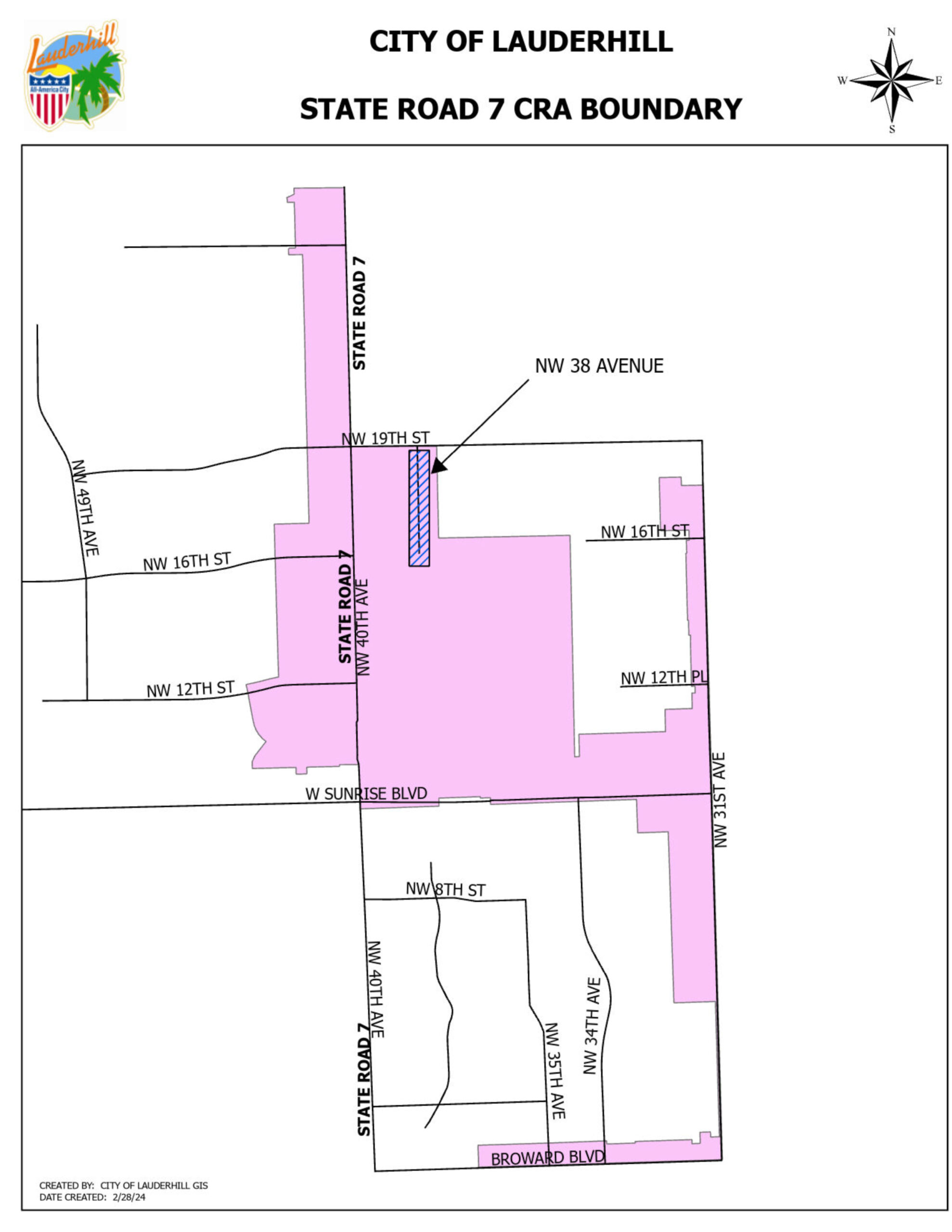
Since then, the City of Lauderhill and the Lauderhill (CRA) have been working hard to transform the State Road 7 CRA, into an illustrious and prosperous corridor that is not only aesthetically pleasing, but also creates a sense of place that reflects the diversity of cultures in Lauderhill. The State Road 7 CRA, is an area that roughly stretches from Sunrise Boulevard to just North of NW 26th Street along State Road 7, also known as US Route 441.This area is also referred to as the “Eastern CRA”

Plans & Maps

The City of Lauderhill and the Lauderhill Community Redevelopment Agency (CRA) have developed a bold, comprehensive plan to reverse decades of slow decline in the State Road 7 corridor and to transform it into a showcase of diversity, style, and function in Broward County. The plan, already in progress, features infrastructure improvements that are not only aesthetically pleasing but which also, taken as a whole, create a sense of place that reflects the diversity of cultures in Lauderhill, defines the City and contributes to its moniker as an All-America City.

The plan leverages a new Broward County Regional Park and Cricket field as a magnet for international tourism and housing development. Finally, the plan calls for active public involvement in the redevelopment process through land acquisition and zoning changes that allow for partnerships with private developers that share the same vision of the plan. For more information on development opportunities within our CRA boundaries please contact our Economic Development Division.

Projects

Project 1: 38th Avenue

Project 2: Leparc

Project 3: Lauderhill Market Place

Project 4: 38th Avenue Extension